


NavLink is a brilliant, full function charting app for iOS. Use it on iPhone or iPad and you’ll transform your device into a full function chart plotter with detailed NOAA charts and the ability to interface with Digital Yacht wireless products to overlay AIS data and take a GPS feed from the boat’s system.
Detailed NOAA charts are included for the whole of the US with user defined layers so you can tailor the chart detail to your requirements. Build a route, measure a bearing and distance and use your tablet for real time navigation. The AIS presentation is fantastic with scaleable target size and full drill down info. To get it, just visit the App Store on your iOS device and search for NavLink US. Canadian charts are available as an in app purchase.
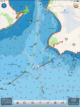
But what about if you want the traditional NOAA paper chart look.
Great News! It’s now available so you can switch between the flexibility of vector charts and the familiar feel of paper all at the click of a button – and for no extra cost! What’s more, existing app users can update FREE too – just update the app through the Apple store. The images above and below show what to expect and how they compare.
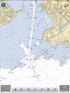
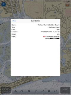
Personally I’m a fan of the old fashioned raster presentation but one of the limitations has been that you can’t drill down on specific data like buoy light data. NavLink’s unique vector and raster options allow you this flexibility. Click on an object even on the raster layer and you’ll get drill down info just like below.
Navigation on board has never been easier and more affordable with iPad and iPhone apps and Digital Yacht’s NavLink just made it better. Get it today from the App store – just search NavLink US