


AtoN stands for Aid to Navigation. These are systems or devices designed to assist mariners in determining their position, safely navigating waterways, and avoiding hazards. Traditionally, AtoNs include physical structures like buoys, lighthouses, and beacons.
However, with technological advancements, AIS AtoN (Automatic Identification System Aid to Navigation) has emerged as a digital evolution of this concept.
AIS AtoN is the digital revolution of navigation aid
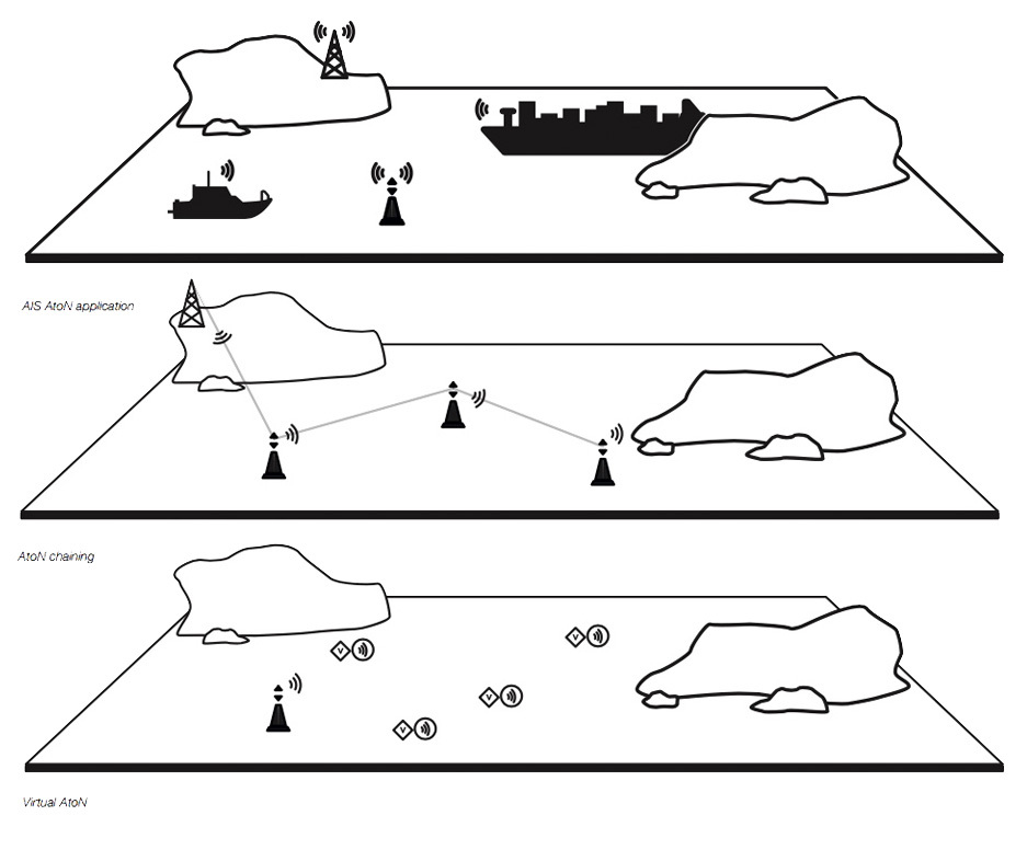
AIS AtoN integrates traditional navigation aids into the AIS network, allowing them to broadcast their position and status electronically to nearby vessels and coastal stations equipped with AIS receivers & transponders. This enhances visibility, safety, and access to additional information such as weather, tide, or sea state data.
Though not classes, there are three types of AIS Aids to Navigation (AtoN):
- Physical AtoN – Actual, physical navigation aid fitted with AIS.
- Virtual AtoN – No physical presence; AIS Message 21 represents a non-existent aid.
- Synthetic AtoN – A real AtoN exists, but the AIS message is transmitted from a remote station (e.g., a nearby lighthouse or coastal station).
Applications
Potential applications include:
- Marking offshore structures, wind farms, wrecks, points of interest, or danger areas
- Transfer of local meteorological conditions such as wind, pressure, wave height
- Custom data transmission to base stations such as electrical status, tide, current, salinity measurements
- Localised tide and current information
- Use virtual or synthetic AtoN capability to mark 5 virtual points (ideal for yacht club racing or movable marks)
What is DigAtoN from Digital Yacht?
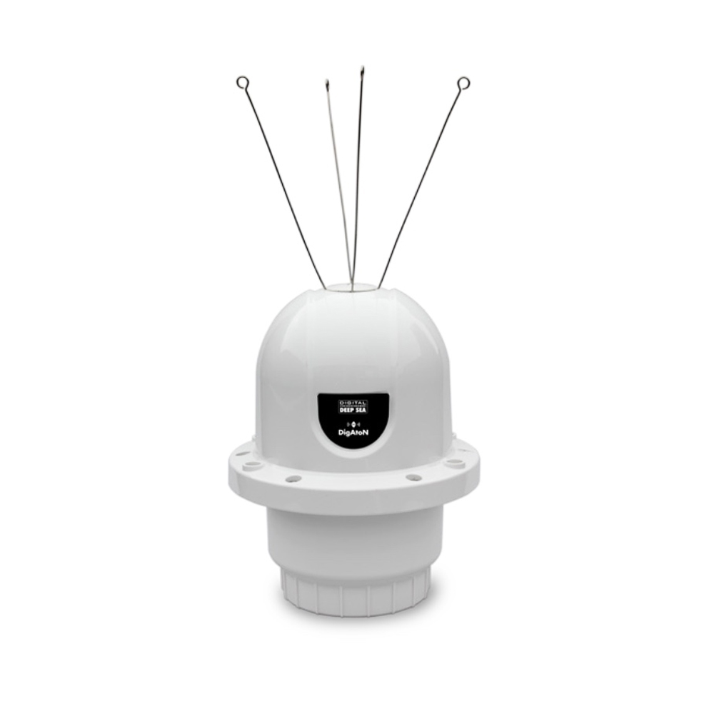
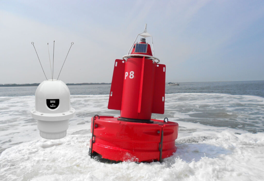
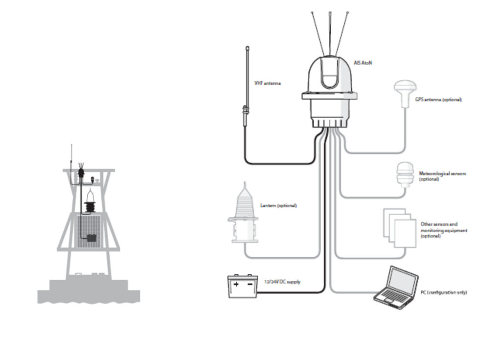
DigAtoN is a Clas 3 AIS AtoN from Digital Yacht. It fit to marine structures, hazards, buoys or can be configured to represent a virtual or synthetic point if mounted remotely from a physical location. AIS equipped vessels and shore stations can then not only identify the position of these marks but also read data (such as weather and instruments) collected by the AtoN.
DigAtoN is also available with an additional sensor interface installed to allow extended monitoring and digital switching capability.
Class 1 or Class 3
The DigAtoN is available as a Class 1 device (transmit only) or a Class 3 device (transmit and receive):
Class 1 devices transmit only AIS message but require a local AIS base station to be operating in the same area as the AtoN.
Class 3 devices transmit but also can receive AIS messages. It can internally allocate slots for transmission, allowing them to be placed anywhere.
Class 3 AIS AtoN devices have the ability to receive AIS messages, which allows them to be remotely configured and monitored using messages sent from a shore station via the VHF Data Link (VDL). This two-way communication also enables wireless chaining, where multiple Class 3 devices (such as DigAtoNs) can relay control and configuration signals between each other. This creates a network of interconnected AtoNs, ideal for extended coverage and more advanced navigation setups.
AIS Message 8
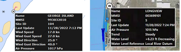
Class 3 AIS AtoN devices also transmit AIS Message 8 which enables the transmission of meteorological, hydrological, operational and custom data. Unlike other AIS messages with fixed formats, Message 8 can carry customized binary data, allowing for flexible information sharing.
- Meteorological data: wind speed and direction, air pressure, temperature, humidity, etc.
- Hydrological data: wave height, tide levels, current speed and direction, salinity, water temperature, etc.
- Sensor status: including data from light sensors, electrical status, battery levels, or operational conditions of the AtoN.
- Custom data: any other digital information that needs to be broadcast, tailored to specific local needs or monitoring requirements.
By broadcasting this data to nearby vessels and AIS base stations, Class 3 AtoNs play a vital role in enhancing navigational safety and providing real-time environmental awareness.
This makes Class 3 devices ideal for complex or dynamic environments, such as offshore installations or mobile aids to navigation.
