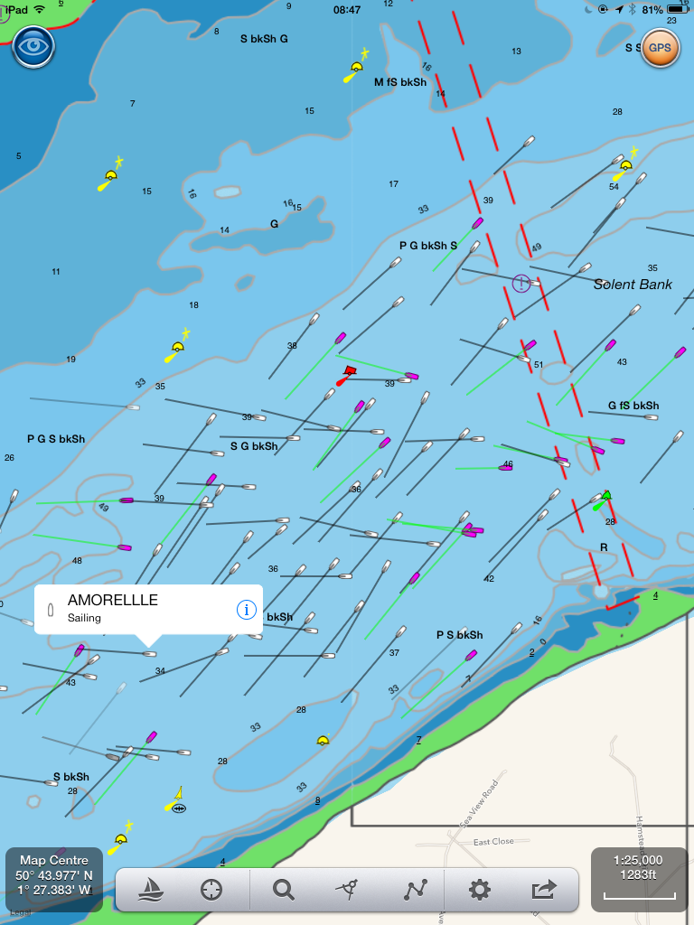
The annual J.P. Morgan Asset Management Round the Island Race, organised by the Island Sailing Club, is a one-day yacht race around the Isle of Wight, an island situated off the south coast of England. The race regularly attracts over 1,700 boats and around 16,000 sailors, making it one of the largest yacht races in the world and the fourth largest participation sporting event in the UK after the London Marathon and the Great North and South Runs. It started today at 0630 and the screen shot below at 0900 shows just how many boats have AIS transponders installed.
It also shows that the AIS system is robust and even in confined areas can handle large amounts of traffic. The image below uses our latest iPad navigation app NavLink UK to show a realtime view of AIS targets. NavLink turns an iPad into a full function touch screen chart plotter with tracking and routing plus real time AIS overlays for just £19.99! Here we can see sailing vessel Amorelle and all the targets around. Of course these views only show vessels equipped with a transponder but there’s also thousands of users utilising AIS with just a receiver – seeing what’s around but not sending their location information. Either way, AIS can only be a brilliant step forward in marine navigation safety and boating fun!
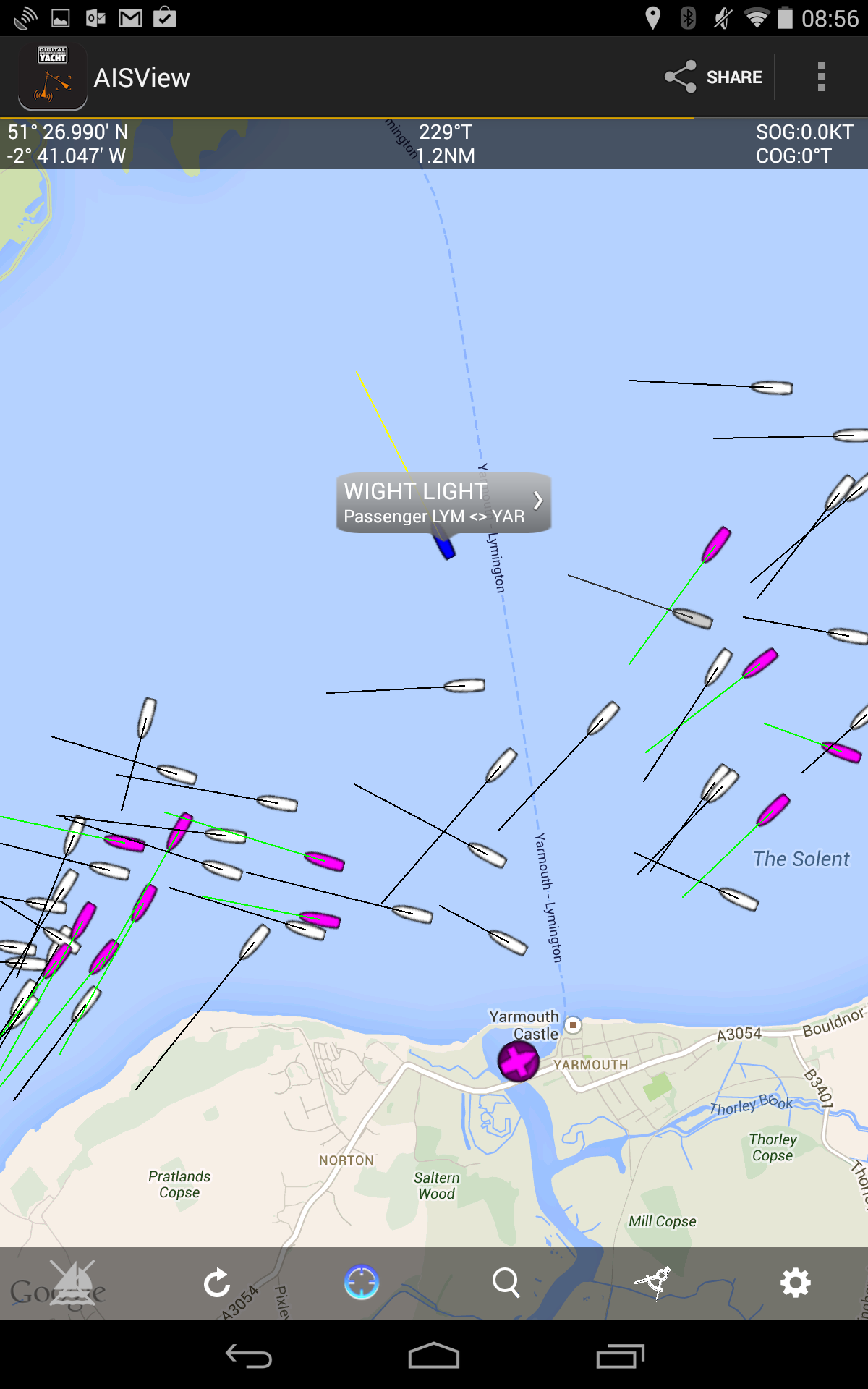
This week we also launched our FIRST Android app called AISView. Unlike NavLink it doesn’t have detailed charts but instead uses either a Google map or radar like PPI/range ring display to show AIS targets.
AISView is the ideal App for anyone wanting to display “live” AIS data from their boat’s AIS receiver or transponder on their Android tablet or smart phone. AISView is designed to receive and display wireless NMEA data from any of Digital Yacht’s NMEA to Wifi devices like the WLN10, NavLink, iNavHub or iAIS.
Although a “wire free” connection is the easiest way to get data in to the tablet, if you do not have one of our wireless NMEA products, you can also connect using Digital Yacht’s USB-NMEA adaptor. Connect this cable to the NMEA0183 output of your AIS and plug the USB connector in to a suitable USB OTG cable for your tablet and you have a simple and cost effective method of getting AIS data in to the tablet
Even if you have a full featured AIS display on your main plotter, having an extra display on a tablet is useful as a repeater or 2nd display. Utilising the internal GPS of the Android tablet, you will also have a completely separate backup system, which should your main plotter fail, will display your position, all of the AIS targets around you and also provide anti-collision alarms with CPA and TCPA calculations.
Once installed, you’ll see an overlay of AIS target information onto a background Google map. Tap on a target and you’ll get a drop down list with identity, heading and closest point of approach (CPA) information. A heading vector makes it easy to see potential collision course targets. Google maps can now be cached if you don’t have an internet connection but even if this feature is not used, AISView will present an attractive radar like visualisation with range rings overlaying the targets around your vessel. Note in the pic above the Lymington – Yarmouth ferry making its way through the Round the Island race fleet!
AISView also supports a simple bearing and distance ruler, compass heading display and current position and track history from the device’s built in GPS. Alarms can be configured for closest point of approach and AIS SARTs – useful for MOB applications. If you have a live internet connection, you can also supplement the real time overlay with AIS information obtained from the popular BoatBeacon internet AIS app (if this is installed) allowing you to view AIS targets in remote ports or locations.
All these are exciting developments for Digital Yacht and we can see how consumer devices are really taking part in real time boat navigation


