


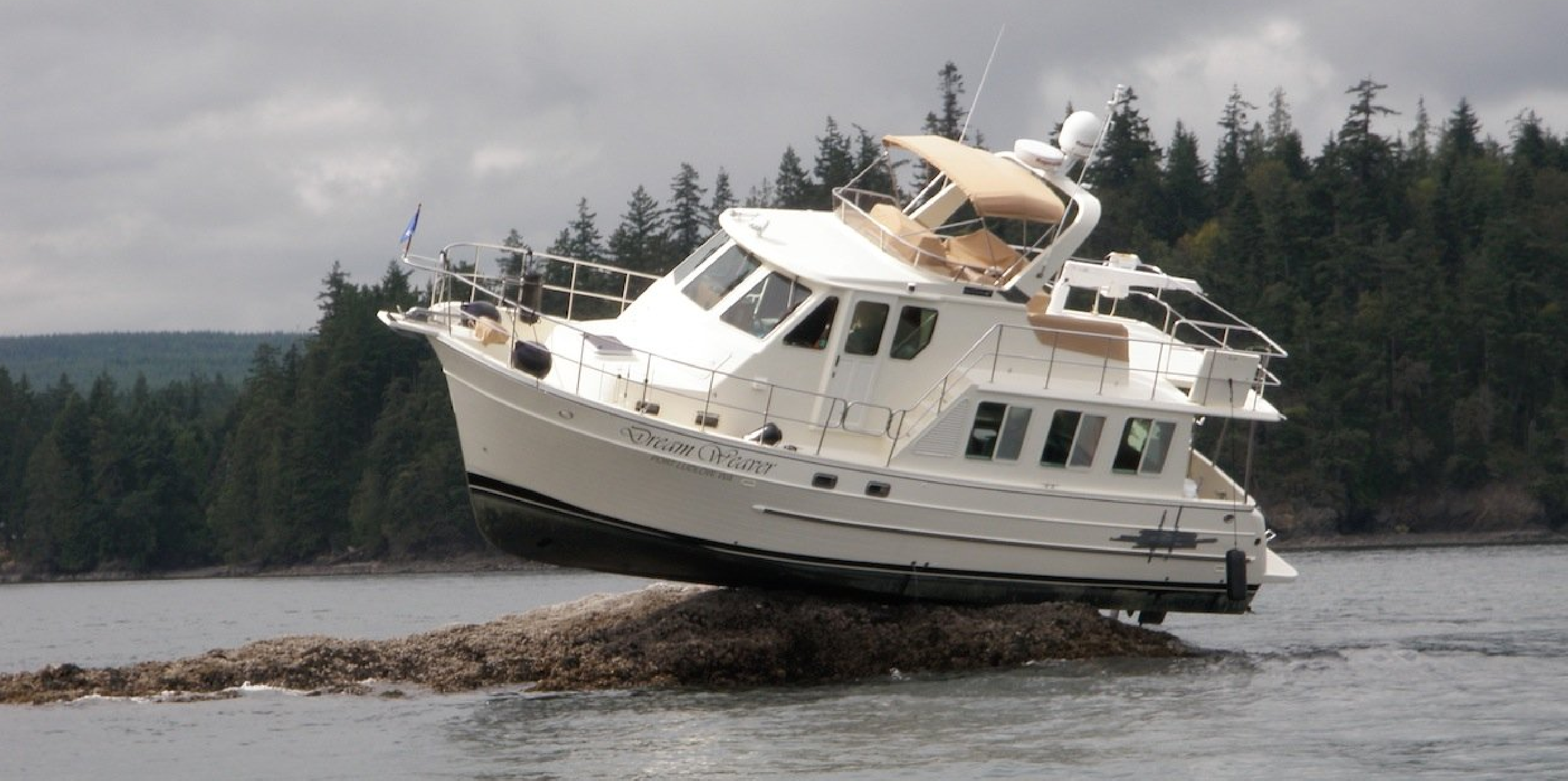
Running aground is every sailors nightmare. Did this poor skipper misread the chart or head over the rocky outcrop as it wasn’t shown on the chart? Either way, with some charts using depth soundings from years ago, it’s time for better charts. How about improved bathymetry and crowd sourced depth data as a 21st century solution?
Sonar Server is Digital Yacht’s low cost gateway from your boat’s NMEA depth instrument or fish-finder to a Smartphone or tablet running the popular Navionic’s charting app. The app now features the ability to redraw bathymetry based on live data streamed from your boat’s system.
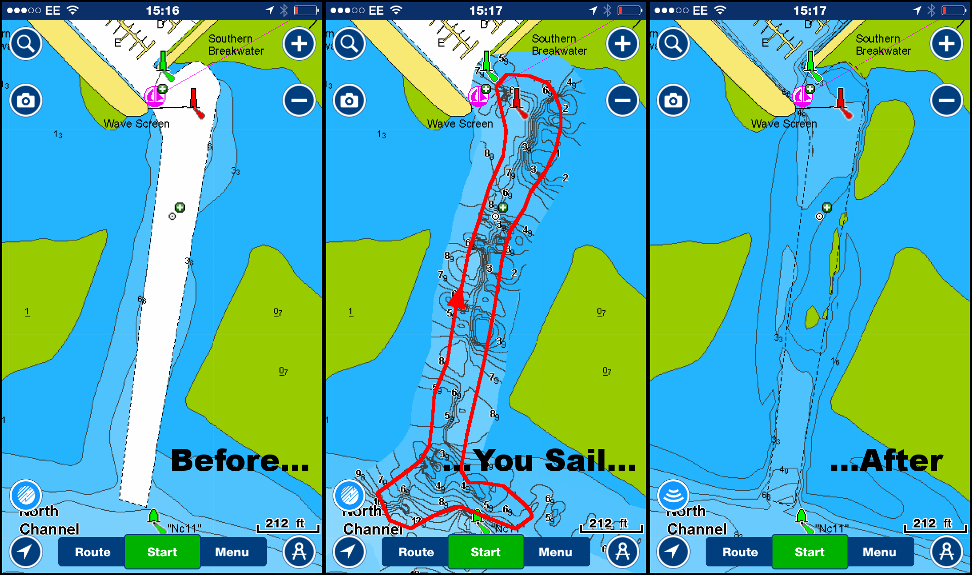
The picture above shows just how well the system works
Before: This shows the dredged channel into the popular Parkstone Bay Yacht Club. The traditional charts just show it as a channel with no depth information
You sail: With SonarServer installed we passed over the channel and you can see our track as the red line. In real time the charting is redrawn on the screen allowing us to reveal hidden depth contours
After: When we return ashore and our SmartPhone or tablet has an internet connection, data is anonymously uploaded to the Navionic’s server for reprocessing. A sophisticated algorithm compares and validates data and allows a new “Sonar Chart” to be created which is then available for all to download next time they update charts in their apps. This process typically takes a couple of weeks. The new data clearly shows some areas on the starboard side of the channel which may cause concern. It’s community boating at its best – as Navionics say, “if you want better charts, just go boating”
Download the brochure from HERE and find out more at www.sonarserver.com
