


It’s always useful to see AIS in action but also to visualise just how easy it makes for collision avoidance and vessel identity. The picture below shows a small RNLI RIB passing from port to starboard, dead ahead

Here’s how its displayed on the nice MaxSea iPad charting app together with a Digital Yacht AIT3000 wireless AIS
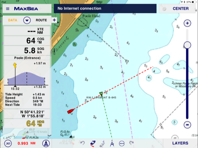
The red boat icon is our current position together with a red heading predictor and the green target icon is the RNLI RIB which is positively identified as RNLI LIFEBOAT B845. You can see at a glance any potential collision situation thanks to the heading vectors and note how the information appears in realtime.
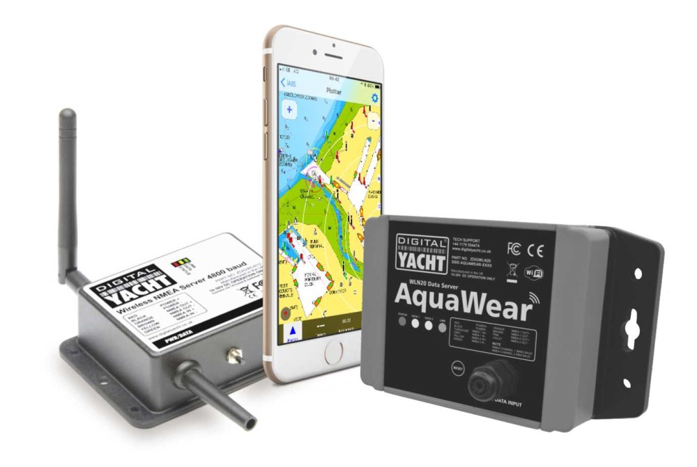
MaxSea is just one app that works brilliantly with any Digital Yacht AIS and wifi server system. GPS and AIS data (together with any NMEA 0183 instrument data connected to the system) is sent wirelessly to the iPad and overlaid onto the app. You can also utilise multiple apps and devices so have one iPad dedicated to one charting system and one to another. Download a list of some of our favourites from HERE
For AIS in the palm of your hand, you can use our iAIS app on an iPhone which also has the option of a Navionics charting overlay. There are literally 100s of possibilities to turn your smart phone or tablet into a full function touch screen navigation device using our wireless servers or dedicated AIT3000
Find our more about the AIT3000 from HERE
