


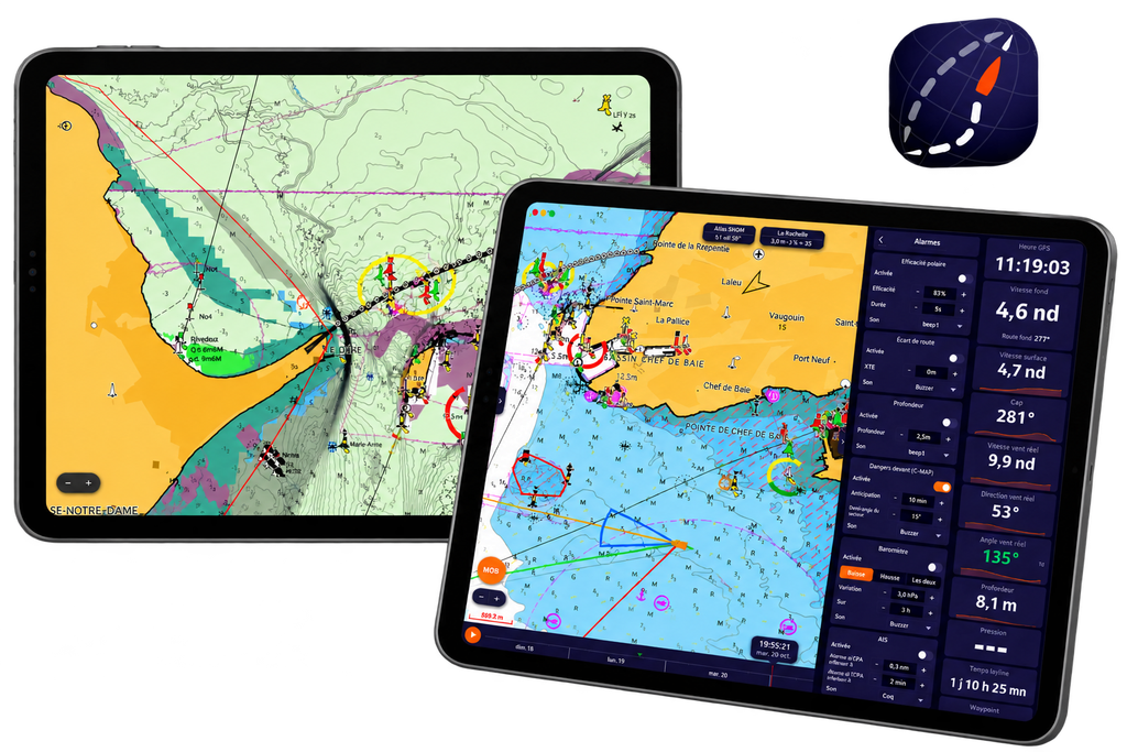
NavimetriX has introduced C-MAP DISCOVER X and REVEAL X charts, bringing advanced marine cartography, intelligent route planning and enhanced seabed information into its navigation application. This major update gives sailors even more tools to plan their passages, identify potential hazards and make better-informed decisions at sea.
C-MAP Charts Now Available in NavimetriX
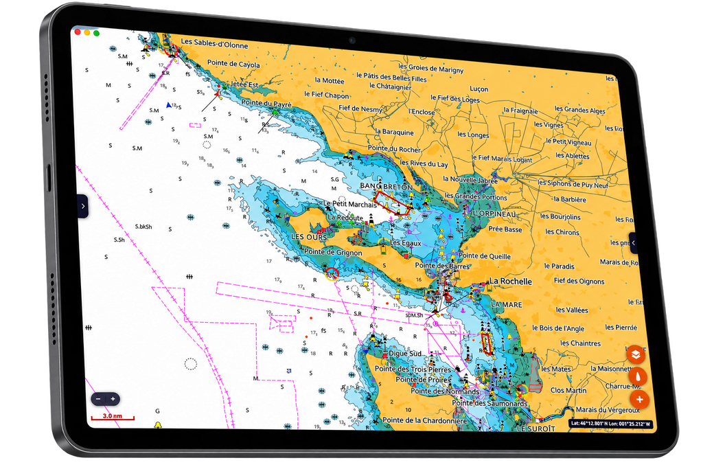
NavimetriX, the multi-platform navigation application designed for sailors and boaters, continues to evolve with the integration of C-MAP marine charts.
The new update introduces C-MAP DISCOVER X and REVEAL X digital charts, combining detailed marine cartography with the application’s existing weather forecasting and routing capabilities.
Users can choose between different chart styles, including a night mode, and benefit from high-resolution bathymetry, depth information and additional navigational details. Charts can also be downloaded for offline use, making them particularly useful when sailing beyond reliable mobile internet coverage.
The digital chart licence also allows charts to be used across multiple devices, subject to the applicable licence conditions.
Smarter Route Planning with C-MAP AutoRouting
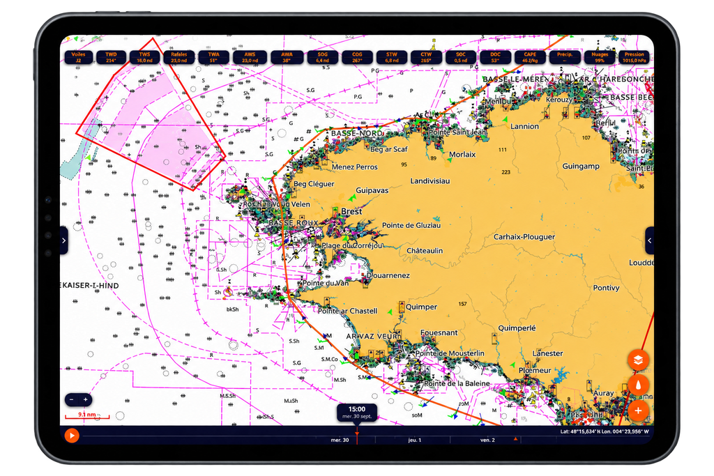
One of the most significant improvements is the new routing engine, which incorporates C-MAP chart information into route calculations.
The system takes into account several important navigational factors, including:
- Water depths and bathymetry: helping identify shallow areas along a planned route.
- Navigational hazards: highlighting potential dangers that require attention.
- Restricted areas: incorporating relevant charted navigation restrictions.
- Buoys and navigational marks: using chart information to improve route planning.
- Tidal information: incorporating available tide data into route calculations.
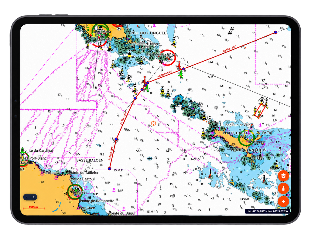
NavimetriX also introduces C-MAP AutoRouting, which can automatically calculate a route from the boat’s current position to a selected destination, taking the vessel’s draft and air draft into account.
An additional Hazards Ahead alarm can alert the navigator to dangers along the planned track.
These tools can make passage planning more efficient, particularly in unfamiliar waters or coastal areas where depth and navigational restrictions are important considerations. However, automatically generated routes should always be checked by the skipper against the latest official charts, notices to mariners and local conditions.
Discover More with C-MAP REVEAL X
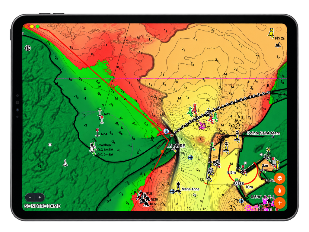
For sailors looking for additional detail, C-MAP REVEAL X introduces enhanced chart layers that help build a clearer picture of the underwater environment.
Depending on the coverage available, these include:
- High-resolution bathymetry: providing a more detailed representation of underwater depths.
- Satellite imagery: offering additional visual context for coastal areas.
- Shaded relief: helping visualise underwater terrain.
- Seabed composition and hardness: providing useful information when assessing potential anchorages.
- Detailed chart inspection: allowing users to access information about chart objects with a long press.
These features are particularly useful when exploring unfamiliar anchorages, assessing seabed conditions or preparing coastal passages.
For cruising sailors, having this information available alongside weather forecasts and route planning tools can simplify the preparation process and help identify areas that deserve closer attention before arrival.
More Than a Marine Charting Application
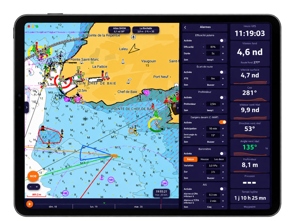
NavimetriX combines marine navigation with advanced weather forecasting and routing tools in a single application.
Its existing capabilities include weather forecasts from multiple models, GRIB file support, wind and wave forecasts, current information, route planning and performance-based weather routing.
The application can also display onboard GPS, NMEA and AIS data when connected to compatible equipment, allowing sailors to combine live navigation information with weather and chart data.
NavimetriX is available on several platforms, including iOS, Android, Windows and macOS. Cloud synchronisation allows users to prepare their navigation at home or in the office and access their projects on compatible devices.
The addition of C-MAP charts strengthens this all-in-one approach, bringing detailed marine cartography and route planning closer together.
Connecting NavimetriX to Your Onboard Navigation Equipment

At Digital Yacht, we develop marine electronics interfaces that allow navigation data to be shared between onboard instruments and compatible navigation applications.
For example, the Digital Yacht NavLINK connects a NMEA 2000 network to compatible navigation applications over Wi-Fi, making it possible to share available instrument and navigation data with connected devices.
Depending on the onboard installation, this can include GPS position, instrument readings and AIS information. This connectivity complements applications such as NavimetriX, enabling boat owners to make better use of the data generated by their onboard electronics.
Find out more about Digital Yacht products integration with NavimetriX

