


A new version of Digital Yacht’s iAIS app is now available that supports a background layer of charting utilising the popular and detailed Navionic’s charts. What’s more, there’s no requirement to re-purchase charts so long as you have a current Navionic’s subscription and app on the iOS device. The Navionic’s charting layer can be enabled with a low cost in app purchase.

iAIS is designed for operation with any of Digital Yacht’s wireless AIS products like the Nomad, iAIS, AIT3000 or WLN10HS connected to our AIT1500/2000 or any AIS receiver. Once connected, it will overlay all AIS targets around your vessel with icons indicating heading of the targets. You can drill down on vessel information by simply tapping the target.
As it’s connected directly to your onboard AIS, there’s no target lag or reliance on an internet based AIS system – targets are updated in real time without the need for internet access.
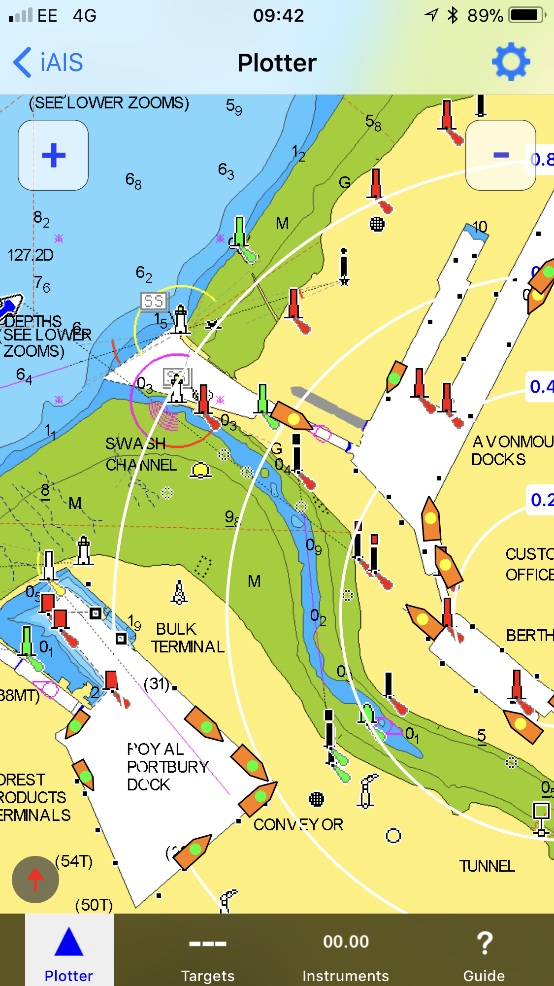
The above screen shot shows a typical view of AIS targets.
As an additional feature, users can also enter their MMSI into the app and relay their boat position to an internet server which will then allow a display on popular web internet services like Marine Traffic even if there are no base stations within range. This function relies on cellular connectivity on the iPhone or iPad.
Both TCP/IP and UDP connection modes are supported allowing connection to multiple devices via UDP if required. Charts can be panned and zoomed and once downloaded are stored in the app so no internet connectivity is required. Users can choose between a north up or course up (default) presentation too.
- Navionics charting now available as a back ground layer just add a low cost, in app purchase on iAIS app
- Real time AIS target overlay with full drill down data on detailed Navionics charts
- Real time position from AIS transponder
- Pan and zoom around the chart
- Centre on targets or boat position
- Tapable targets and target list
- Choice of north up or course up charting displays
- Range rings
- No repurchase necessary of Navionic’s charts – just login to your Navionic’s account
- iPad and iPhone compatible
- Works with any of Digital Yacht’s wireless AIS products or wireless NMEA servers connected to an AIS device
To get iAIS, simply visit the app store on your iPhone or iPad and search for iAIS or follow the link HERE
