For decades, NV Charts have been creating nautical charts for the Baltic Sea, North Sea, Kattegat, Skagerak and the Norwegian south coast. Chart coverage now extends to the UK, European Atlantic Coast, E Coast USA, Caribbean and Mediterranean. With a keen eye on detail and precise local knowledge, every nautical chart is designed from the best available data. In many cases, their own detailed survey data supplements official hydrographic office charts. NV Charts are also easy to read have have a nice colour palette and font/symbol schema. Their charts are available in paper and digital format – and if you purchase a paper chart, it comes with a free app download too. That’s great – traditional navigation meets the iPad!
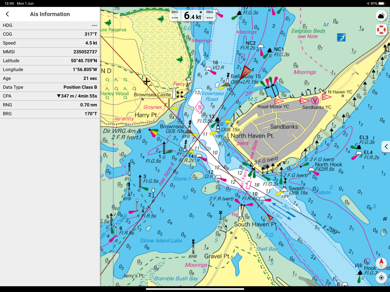
The electronic version is now compatible with Digital Yacht AIS products and NMEA to wireless interfaces. This means the boat’s AIS, instrument and GPS data can be overlaid onto the detailed charts turning your device (iPad or tablet) into a full function electronic chart system with routing, real time tracking and AIS overlays. We took an iPad for a test with NV and the Digital Yacht AIT3000 and iAISTX Class B transponder. You’ll see in the screen shot below the bright, easy to use colour scheme and icons for navigation marks. Your current position from the boat’s GPS (which is much better than the battery thirsty internal GPS on some tablets) shows as a bold, red triangle with a heading vector. Using the boat’s system means you don’t need an expensive GPS/Cellular enabled iPad and of course, no connection to the internet is required.

Just enable AIS and targets display automatically. You’ll see the target just to the east of South Haven Point with a heading predictor showing a potential collision point. Click on the target and more information is displayed in the data window – also calculating CPA (closest point of approach) and TCPA (time to CPA), range and bearing.
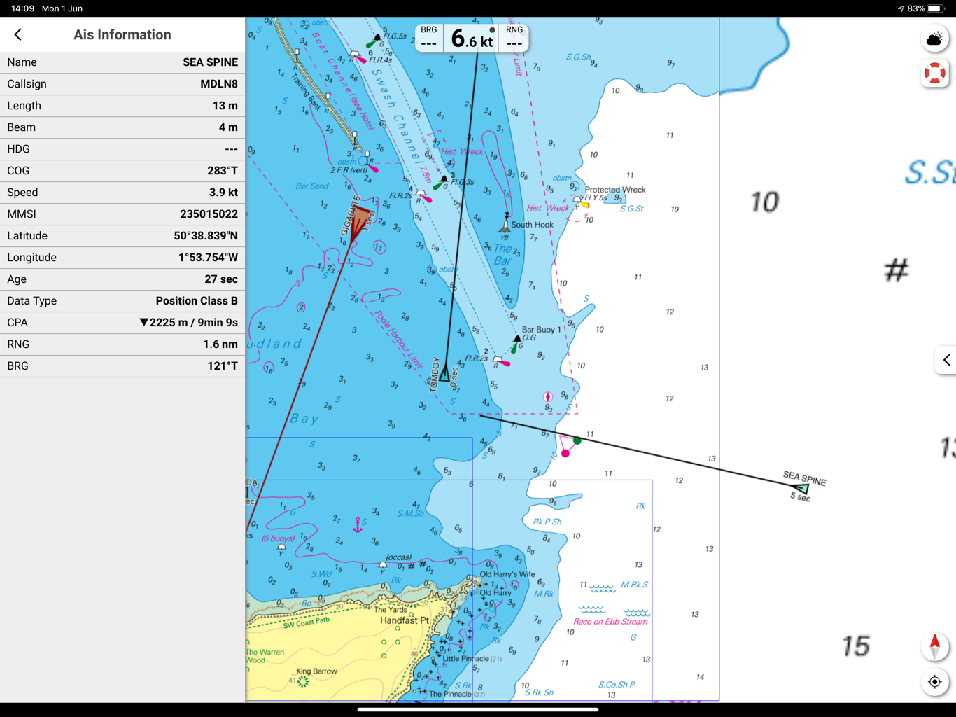
Charts can be configured for head up and north up presentation and waypoints and routes can be created in seconds. There’s also a neat logbook function which can have pictures attached. The screen shot below also shows targets with name data attached – great to initiate a VHF call to a potential collision target or boating buddy
This is all good stuff – and a real reason to use an iPad for all your boats navigation tasks. Not only do Digital Yacht wireless nav solutions offer great value for money but you can now have a choice of multiple apps with multiple chart types turning your iPad into a true multi chart system. For UK waters, iPad apps now offer compatability with C-Map, UKHO/Admiralty, Navionics, S57 Vector ECDIS style, Imray and now NV. Easy to use, sophisticated and low costs apps for next generation navigation.


